
The American Southwest Road Trip: A Region-by-Region Planning Resource

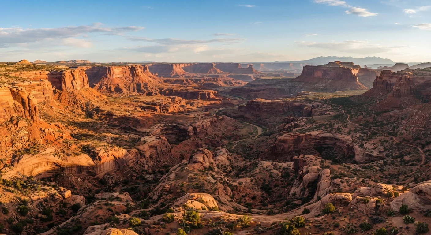
Photo: ScoutAnswers.com | Blogs That Ignite Curiosity editorial
What the Southwest Actually Covers
The American Southwest is commonly understood to include five core states: Arizona, New Mexico, Utah, Nevada, and Colorado - though definitions vary. Each state contains multiple distinct sub-regions with different elevations, climates, and experiences. Treating the Southwest as a single destination is a planning mistake; it's better approached as a collection of loosely connected corridors. Before committing to an itinerary, see our step-by-step trip planning guide for how to structure your research phase.
Road trippers also benefit from deciding early whether a drive-focused format makes sense for them. The road trip vs. fly-and-explore comparison can help with that decision, especially when covering long distances between parks.
Region-by-Region Overview
Colorado Plateau (Utah & Northern Arizona)
This high-desert plateau - generally 4,500 to 7,000 feet in elevation - is home to some of the most recognized landscapes in the country: Zion, Bryce Canyon, Arches, Canyonlands, and the Grand Canyon's South Rim. Summers are hot in the canyons but cooler at elevation. Spring and fall are widely considered the most comfortable for hiking. Flash flooding is a genuine hazard in slot canyons from July through September.
Sonoran Desert (Southern Arizona)
Centered on Tucson and extending into Mexico, the Sonoran Desert supports more plant diversity than most North American deserts, including the iconic saguaro cactus. Temperatures routinely exceed 100°F in summer. Winter months (November-February) are mild and popular with long-stay visitors. Saguaro National Park, Chiricahua National Monument, and the Organ Pipe Cactus National Monument are key draws.
New Mexico's Cultural Corridor
Running along the Rio Grande from Albuquerque north through Santa Fe and Taos, this corridor offers a layered mix of Indigenous Pueblo history, Spanish colonial architecture, and high-desert scenery. Elevations here run 5,000-7,000 feet, making summers significantly cooler than low-desert Arizona. White Sands National Park, in the south, offers a strikingly different landscape - vast gypsum dunes at around 4,000 feet.
Nevada's Desert Basin
Beyond Las Vegas - a common entry and exit point for Southwest loops - Nevada holds the Mojave Desert, Great Basin terrain, and Valley of Fire State Park. Las Vegas functions as a logistical hub more than a natural destination; many road trippers use it as a base for day trips to Red Rock Canyon or as a transit point toward Utah or California.
Colorado's Southern Edge
Mesa Verde National Park, the San Juan Mountains, and the Great Sand Dunes National Park form the Southwest's northeastern fringe. This region connects well to New Mexico itineraries and offers meaningful elevation gain - the Great Sand Dunes sit adjacent to 14,000-foot peaks, creating an unusual visual contrast. See underappreciated national parks worth visiting for deeper context on Great Sand Dunes and Mesa Verde.
Climate, Timing, and Entry Points
Climate varies sharply by elevation and season. The Colorado Plateau and New Mexico corridor are most accessible in April-May and September-October. Southern Arizona's low desert is best visited November-March. Summer travel is possible but requires early starts, shade planning, and significant hydration - trail closures during extreme heat are enforced at some parks.
Colorado Plateau
A high-elevation geological region covering parts of Utah, Arizona, Colorado, and New Mexico, characterized by layered sedimentary rock, deep canyons, and mesa formations.
Slot Canyon
A narrow canyon carved by water erosion through soft sandstone or limestone, often only a few feet wide. Flash flooding can occur in slot canyons even when skies are clear upstream.
Timed Entry Permit
A reservation system used by some national parks to limit daily visitor numbers and reduce congestion at popular trailheads or entry gates. Typically booked through recreation.gov.
Saguaro
A large columnar cactus native to the Sonoran Desert, recognized by its tall trunk and arm-like branches. Protected by law; removing or damaging one is a criminal offense in Arizona.
Mighty Five
An informal name for Utah's five national parks: Zion, Bryce Canyon, Capitol Reef, Arches, and Canyonlands - often combined into a single road trip loop.
Common driving entry points include:
- Las Vegas (LAS) - closest major airport to Zion, Bryce, and Death Valley
- Phoenix (PHX) - gateway to the Sonoran Desert and Grand Canyon's South Rim (~3.5 hours)
- Albuquerque (ABQ) - central to New Mexico's cultural corridor and within reach of Colorado
- Salt Lake City (SLC) - best starting point for Utah's Mighty Five parks
For a comprehensive framework covering every planning stage, the Trip Planning A to Z guide is a useful companion resource. Always verify current road conditions, permit requirements, and park reservation systems directly with the National Park Service before your trip, as these change regularly.
This article is a general travel reference. Entry requirements, road conditions, park permits, and safety advisories should be confirmed with official government and park sources prior to traveling.
The content on this site is for informational purposes only and is not a substitute for professional advice. Always consult a qualified professional for guidance specific to your situation.